Datacode Geosciences a unique Indian company, provides consulting and technology solution to the Geo-Science industry. A team of youthful experts under the guidance of experienced professionals strive to provide need-based solution through technology & consulting coupled with training for achieving the defined goal. Datacode’s team has mastered the art of extracting the knowledge and insights from the geoscientific data.
About Datacode
Datacode understands the needs of clients. To unravel the hidden treasure be it minerals or oil and gas or Ground Water or to understand the formation structure to develop large infrastructure like Dam or bridges or tunnels.
We at Datacode, Understand and appreciate your challenges of solving the problem and at the same time keep the cost under check. This gives us an opportunity to work with you and bring in the industry’s best global solution for you needs. Our team for Geo-Scientist has been delivering the solution over twenty-five (25) years.
The interpretation and visualization is key to exploration project, we at Datacode are focused on providing 3D solutions that enable our clients to have effective and detailed control on various aspects of the project. Our products cater to ever gamete of Geo-Sc problems, be it near surface geo-technical problems or deep seated mineral deposits or requirements of the Oil& Gas industry. We have products which integrate multi-discipline data be it Remote Sensing, Geology, Geophysics, Geochemistry, geotechnical, etc or also allow to work independently on each of these data sets
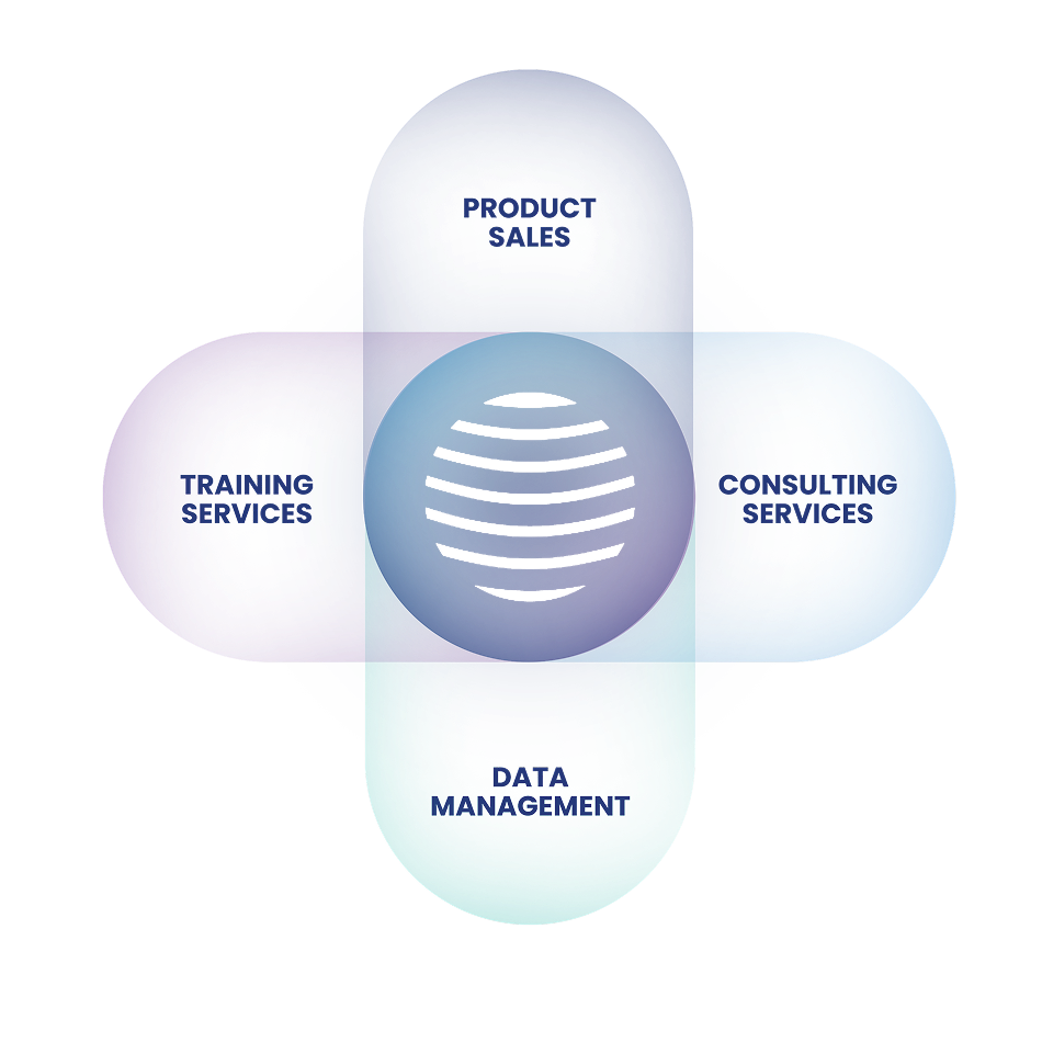
Consulting Service
Sub surface studies are unique to the objective of the studies and nature of problem one needs to address. As a client you look for tailored solution for you local problem or specific need, Which is Datacode brings to the table with if global team of experts and experience. We have delivered service from defining a problem statement, planning the process of finding a solution, and ensuring that the right quality of data is collected to achieve the result. This results into valuable mapping, 3d modeling, reporting in cost-conscious methodology
Training
As we all understand and appreciate the basic science doesn’t change, however with time new tools, technology and interpretation results into solving the problem in more efficient way (Time & money). Upskilling the new development and use of new technology, tools or sharing in knowledge learning and teaching is part of human nature. So we adopted the same as part of our company DNA, We not only conduct training based on specific software tools but also run courses which results into sharing knowledge beyond an academic degree. The courses like Geophysics for Geologist of visa-a-versa gives exploration teams to work in symphony and achieve best possible constrain modeling for predicative analysis
Our training courses are designed for every learner, be a fresher or an senior experienced professional. One may also appreciate that these training being practical oriented and defined by industry experts or people with insight of the subject and experience. Which makes learning a refreshing process. Our Learning Program’s are scientifically design and developed with client data set so that you can put the training effectively to use from next day itself
Geodata Management Services
Geo-Sc Data-SET NEVER DIES. All other industry data have a shelf life However GeoSc data is one set of data which is relevant over centuries. We are purposefully using the word DATA-SET not data, since the data without understanding metadata or reading the report could result in a wrong interpretation. As an example, if we have done sampling at 1 KM spacing a small vein of gold deposit will not be mapped So it is important to understand what has been behind the data which is generally found in metadata or reports which makes it a complete Data-Set. We at Datacode have developed the expertise to handle simple geological data having various attributes, or Geochemical data which have tabular assay values, or Geophysical Data which has varied formats depending on the geophysical technique used. In fact, as user you would appreciate the Geo-Sc data is truly 4D data having X, Y,Z, and time as the 4th Scale. The data set which is used at the start of any exploration or exploitation project is valuable even at fag end of the project cycle for closure of the project.
The value and knowledge drawn from the Geo-Sc data set is of immense human value and acquiring the data requires a good amount of financial and time investment so robust system that captures every aspect of data and stores and decimates in user-friendly or software format is very critical for any Geo-Sc projects
Business Associates
Our associates are an integral part of our business and that is why we believe in growing with our people by establishing long-term partnerships and incentivizing performance. Through a robust network of associates, we have successfully established a vast presence globally elevate the socio-economic landscape in these cities.