Rockworks

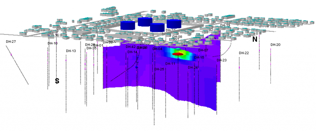
RockWorks is a comprehensive geological and geotechnical software platform designed for creating 2D and 3D maps, logs, cross sections, fence diagrams, and subsurface models. Widely used across mining, environmental, petroleum, and geotechnical industries, it enables professionals to visualise, analyse, and interpret complex geological data with accuracy and efficiency.

Integrated Geological Modelling & Subsurface Data Visualisation

RockWorks helps geoscientists and engineers transform borehole and surface data into powerful geological models for better planning, resource evaluation, and site analysis. With advanced tools for contouring, volumetric calculations, hydrogeology, stratigraphy, and 3D visualisation, the platform streamlines geological interpretation and improves project decision-making across multiple industries.

Product Enquiry

Name